The lake has gone way down. As October ends, the broad sand beach here is broader than we have ever seen it. But we have only lived here for 36 years, so that’s pretty close to no time at all. The water level has dropped below the “lowest ever” level we saw in early November, 2006. (Of course I say “lowest ever” with tongue in cheek.) That year, in the “tidal flats” alongside what we call Windmill Island (an island sometimes, a rocky peninsula or Presque Isle when not) my sharp-eyed friend Mitch discovered what turned out to be parts and pieces of an old birchbark canoe, encased in the thick clay and silt of the lake-bottom. Flakes of bark, lashed with spruce-root to delicate bands of gunwale.
Someone’s canoe, pulled up, left behind, then flooded and gradually buried. Clearly, the lake had been this low before, we mused. But when? A hundred years ago?
That’s what I have been musing about again these past couple of months. Not raised beaches, which the geologists so handily point out here and there, but lowered beaches — which are not so easy to point out at all. We can only imagine them. Any beach of bygone low-water eras is now underwater. The gist of it is the realization that for every set of raised beaches, there is probably a lowered beach or two. When water gets high and then subsides, it leaves a tell-tale bathtub ring, or a raised beach, some obvious stains on shoreline rocks, crescents of stranded gravel high up and inland from the “normal” — or what we would better call the “current” shoreline.
We all fall victim to this way of looking at our world , i.e., what we are used to, referenced to our brief three-or-four-score-give-or-take-ten (should we be so fortunate) span of years, goes down on our mental ledger as “normal.”
A raised beach leaves its telltale marks. A lowered beach, that is, a beach flooded and submerged, leaves no such marks. I did read of some stone tools found far out on the continental shelf, in fishing nets off the Carolina coast of the Atlantic. Signs that during the last Ice Age, the sea level had been much lower than it is today. Makes me wonder how far out I might look, and how, and for what, exactly, for any sign that the bay here has in the past been drastically lower than our “normal.” Because I am willing to bet my bottom dollar that it has. Because “the past” is a very long time. And normal is not a very useful word, out in the real world.
I fly above this huge and variable lake a lot, looking down at its coastlines from five hundred to a thousand feet. It is a fantastic vantage point, and I still find it interesting after thousands of hours and thirty-some years. Along the south shore, east of Hay River, the shoreline is flat and the shallow water always extends far out from shore. A few years ago the water there was lapping right up into the trees — some big trees, trees that had taken many decades to grow that big without any flooding. Now, that same stretch of shoreline looks like the tide has gone out. A few weeks back, flying along there, I saw a party of people out on four-wheel ATV’s merrily driving, maybe picnicking or moose hunting, where in August of 2020 they were likely boating without so much as a niggle of concern about nicking the propellers of their outboards. And of course, in other parts of the lake where the shoreline drops straight off into deep water, this recent “drastic” drop of three or four feet of lake level is not even noticeable, because only a foot or two of shoreline is newly exposed. It all depends. In 2000 feet of water, a two-foot drop is not “drastic.” Two hundred might be.
It is wondrous how quickly new vegetation marches out to colonize the “tidal flats” as soon as the water level drops. It’s first-come, first-served, in a wide swath of mucky substrate suddenly exposed to warm summer sun, and the tiny blades of greenery appear there within weeks. A few storms may wash water over them, but if the lake continues to drop, those early settlers will be followed by alder, willow, and eventually even spruce and birch. And every creature affiliated with that shoreline will adapt. What choice will we all have?
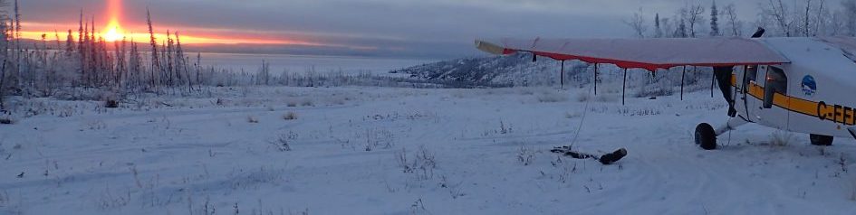
This year by the first of September all of our docks, ramps, piers and fuel cache access points were high and dry and utterly useless. We moved our entire floatplane operation — planes, boats, fueling gear, pull-out ramps — half a mile east down the shoreline to the river mouth. The August fuel barge could not come anywhere close to our shoreline here or at the river, so we directed it in to the deep bay we call Blue Fox, just over the ridge to the west, and offloaded it there. Things became a little less convenient, with over a mile between the two ends of our workaday world.
If the water goes down still farther, and the enormous hydraulic forces of monstrous waves and big autumn storms have a few years to sculpt these new shoreline edges, unexpected places will suddenly become candidates for getting into shore, pulling up a boat, dipping a water pail, or landing a barge. Places I can’t even guess at yet. We will adapt. I think it will be kind of interesting.
If the water comes up again (spoiler alert — it will), we will adapt again. It is what we all do. It is what everything does. Adaptation is survival. The alternative is extinction.
